

Tungnath Height From Sea Level
Tungnath Height From Sea Level – Tungnath is one of the most sacred and breathtaking destinations in the Indian Himalayas. Located in the Rudraprayag district of Uttarakhand, Tungnath is world-famous for being the highest Shiva temple in the world. Apart from its deep religious significance, Tungnath attracts adventure lovers, trekkers, photographers, and nature enthusiasts because of its high altitude, stunning alpine views, and peaceful surroundings.
One of the most common questions asked by travelers and pilgrims is, “What is Tungnath’s height from sea level?” The elevation plays a major role in Tungnath’s climate, trekking conditions, oxygen levels, and overall travel experience. In this blog, we’ll cover Tungnath’s exact altitude, how it impacts weather and trekking, best visiting seasons, and important travel tips.
🏔️ What Is Tungnath Height From Sea Level?
Tungnath is situated at a very high elevation in the Garhwal Himalayas, making it a true high-altitude pilgrimage site.
🌟 Tungnath Height From Sea Level: Approximately 3,680 meters (12,073 feet)
This remarkable elevation makes Tungnath the highest of the Panch Kedar temples and a destination that demands physical readiness and proper planning.
📊 Tungnath Elevation & Key Information Table
Here is a simple table to help you understand Tungnath’s altitude and related details clearly:
| Parameter | Details |
|---|---|
| Tungnath Height From Sea Level | 3,680 meters (12,073 feet) |
| Location | Rudraprayag district, Uttarakhand |
| Mountain Range | Garhwal Himalayas |
| Religious Importance | Highest Shiva temple in the world |
| Trek Distance | ~3.5 km from Chopta |
| Best Time to Visit | May to June & Sept to Oct |
| Winter Access | Closed due to heavy snowfall |
| Nearest Town | Chopta |
| Nearest Airport | Jolly Grant, Dehradun |
🌬️ How Tungnath’s Height Affects Climate & Weather
Due to its very high altitude, Tungnath experiences extreme and rapidly changing weather conditions:
❄️ Cold Temperatures
Even during summer, temperatures near Tungnath remain cool, often ranging between 5°C and 15°C. Nights can be freezing.
🌨️ Heavy Snowfall in Winter
From November to April, Tungnath receives heavy snowfall, making the temple inaccessible. The deity is shifted to Mukumath village during this period.
🌥️ Thin Air & Oxygen Levels
At nearly 3,700 meters above sea level, oxygen levels are lower, which may cause mild altitude sickness for some visitors.
🥾 Tungnath Trek & Altitude Challenges
The trek to Tungnath starts from Chopta, which itself is located at an altitude of around 2,680 meters (8,790 feet). While the trek distance is short, the altitude gain is significant.
🚶 Trek Highlights
-
Well-defined trekking path
-
Gradual but steady ascent
-
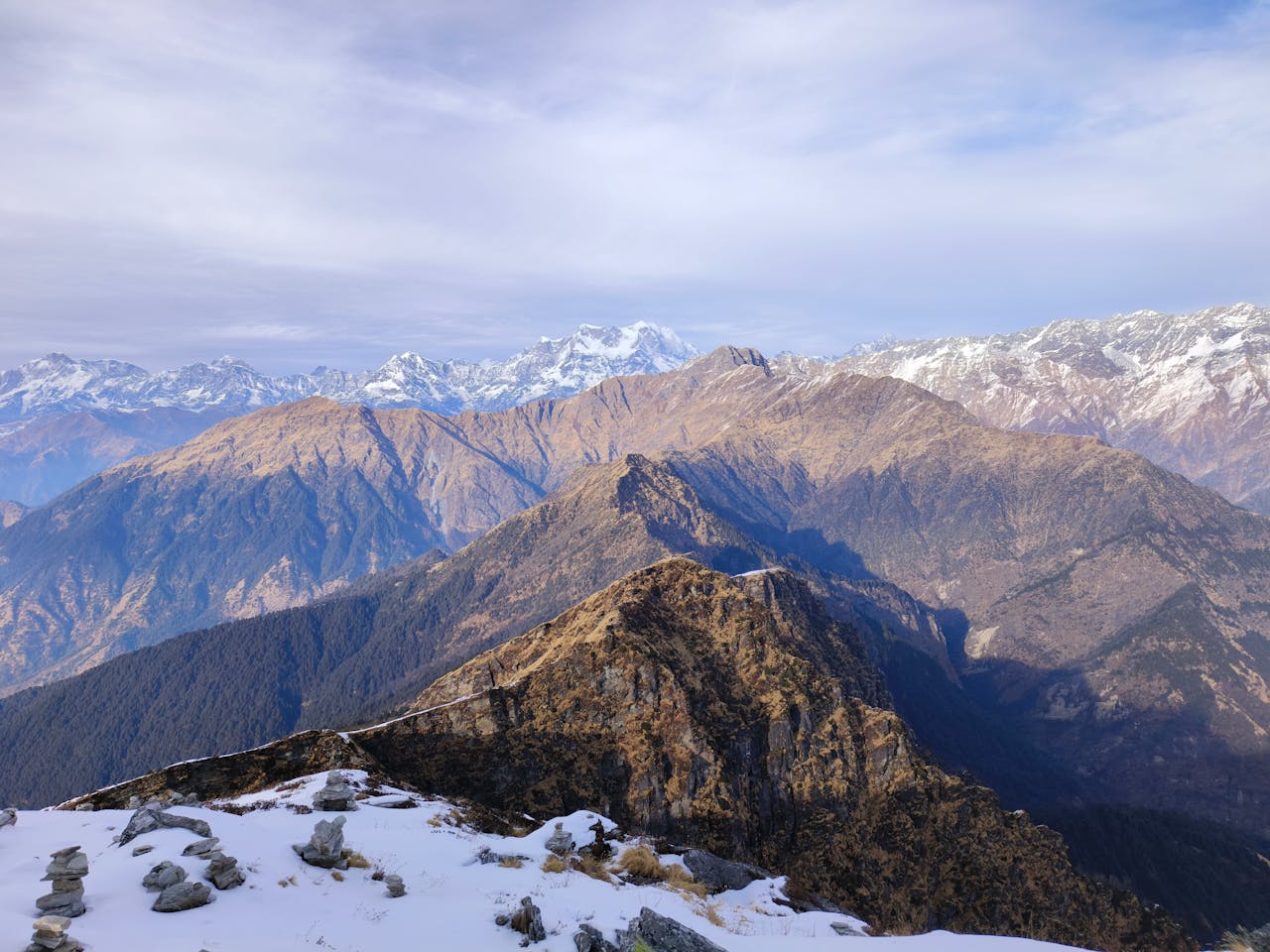
Panoramic Himalayan views
-
Alpine meadows and forests
⚠️ Altitude Considerations
-
Slow pace is essential
-
Stay hydrated
-
Avoid alcohol before trekking
-
Acclimatize properly at Chopta
Because of Tungnath’s height from sea level, beginners should take necessary precautions.
🛕 Religious Significance at High Altitude
Tungnath is part of the Panch Kedar pilgrimage, associated with Lord Shiva. According to legends, the arms of Lord Shiva appeared here after the Mahabharata war. Performing darshan at such a high altitude adds a sense of spiritual achievement for devotees.
The serene surroundings, thin mountain air, and majestic views enhance the spiritual atmosphere, making Tungnath a truly divine experience.
🌄 Nearby Attractions Around Tungnath
Thanks to its elevation, Tungnath is surrounded by stunning Himalayan landmarks:
-
Chandrashila Peak (4,000+ meters) – Offers 360° Himalayan views
-
Chopta – Known as the “Mini Switzerland of India”
-
Deoria Tal – High-altitude lake with reflections of peaks
-
Mukumath Village – Winter seat of Tungnath deity
These places are often combined into a single trip with Tungnath.
🚗 How to Reach Tungnath
Despite its high altitude, Tungnath is accessible with proper planning:
-
By Air: Jolly Grant Airport, Dehradun (approx. 220 km)
-
By Rail: Rishikesh Railway Station (210 km)
-
By Road: Well-connected roads to Chopta via Rudraprayag
From Chopta, a 3.5 km trek leads you to Tungnath Temple.
🧳 Best Time to Visit Tungnath
Due to Tungnath’s height from sea level, timing your visit is crucial:
-
May to June: Pleasant weather, clear views
-
September to October: Best for trekking & photography
-
July–August: Risky due to monsoon
-
November–April: Closed due to snow
📝 Conclusion – Why Tungnath Height From Sea Level Is Important
The Tungnath height from sea level—around 3,680 meters (12,073 feet)—defines everything about this destination, from climate and trekking difficulty to spiritual significance. Its elevation makes Tungnath not just a pilgrimage, but a high-altitude Himalayan experience that combines devotion, adventure, and natural beauty.
Whether you are a pilgrim seeking blessings or a trekker chasing mountain views, understanding Tungnath’s altitude helps you prepare better and enjoy the journey safely.
For travelers looking to explore destinations, hill stations, and nearby tourist places, TopChandigarh.com is a helpful blog that offers informative travel content. It covers popular and offbeat locations with useful insights, making it easier for readers to plan memorable trips across India.