
Mysore Height From Sea Level – Complete Travel Guide
Mysore Height From Sea Level – Mysore (officially Mysuru) is one of India’s most culturally rich and historically significant cities — known for its palaces, heritage, and pleasant climate. Located in the southern state of Karnataka, its elevation above sea level has a direct influence on its weather, environment, and lifestyle. In this detailed guide, we’ll explore Mysore height from sea level, its topography, climate impact, geography, and what that elevation means for residents and travelers. Wikipedia+1
What Is Mysore Height From Sea Level?
Mysore is situated on the Deccan Plateau at an elevation of approximately 770 meters (around 2,530 feet) above mean sea level. Wikipedia+1
While some topographic maps show slight variations — with average elevations ranging from around 727 m to 770 m depending on specific locations in the city — the commonly accepted figure for Mysore altitude is 770 m above sea level. Topographic maps+1
This elevation places Mysore comfortably above many coastal and plains regions of India, contributing to its moderate and pleasant climate for most of the year. mysurulive.in
Where Is Mysore Located?
Mysore lies in the southern part of Karnataka, approximately 140 km (87 miles) southwest of the state capital, Bengaluru. Topographic maps
-
Latitude: ~12° 18′ 26″ N
-
Longitude: ~76° 38′ 59″ E
-
Region: Deccan Plateau
-
Topography: Foothills of the Chamundi Hills, which rise above the city landscape. Topographic maps
Mysore spreads over a gently undulating plateau terrain with higher elevations near Chamundi Hills and lower plains toward the outskirts. cseindia.org
Elevation Range in and Around Mysore
| Area | Approx. Elevation Above Sea Level |
|---|---|
| Mysore City (central) | ~770 m (2,530 ft) Wikipedia |
| Average elevation range | ~727–770 m Topographic maps |
| Chamundi Hills (nearby peak) | Up to ~1,074 m above sea level mysorenature.org |
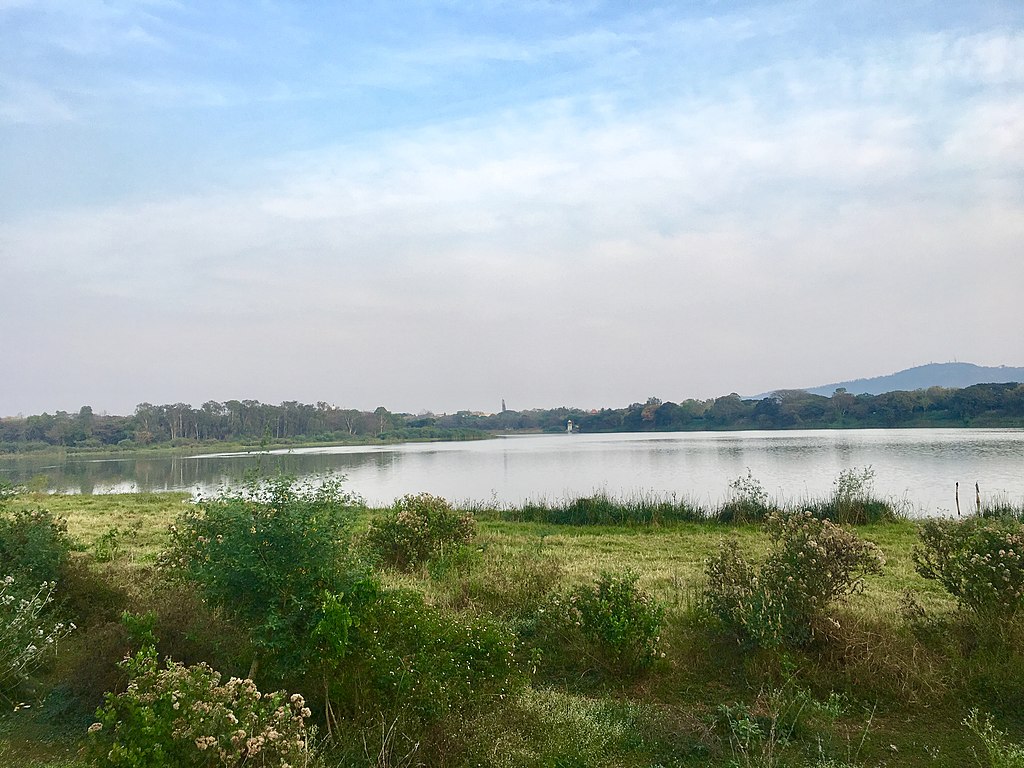
| Kukkarahalli Lake (heart of city) | ~755.7 m Wikipedia |
This varied elevation — higher near hills and slightly lower in some urban parts — contributes to microclimatic differences within the city. Topographic maps
How Elevation Affects Mysore’s Climate
Mysore’s height from sea level plays a major role in shaping its weather and seasons:
Moderate Summers
Unlike many low-lying regions of South India, Mysore’s elevation helps keep summer temperatures milder. Summers usually range from warm to moderately hot. AdoTrip
Monsoon Season
Mysore receives moderate rainfall during the monsoon (June–September). The city’s elevated plateau position helps with runoff and drainage, reducing prolonged waterlogging in most areas. cseindia.org
Pleasant Winters
Winters (December–February) are cool and comfortable, with temperatures often dropping lower than coastal cities in Karnataka. Mysore’s elevation contributes directly to this cool winter climate. AdoTrip
Topography and Geography
Mysore lies at the base of the Chamundi Hills — a rugged range of hills that form a natural backdrop to the city. Topographic maps
The city is part of the Deccan Plateau, which is characterized by:
-
Undulating terrain with gentle slopes. Capacity Building Commission
-
Numerous lakes and water bodies, including Kukkarahalli Lake — a major urban water resource. Wikipedia
-
Proximity to rivers like the Kaveri and Kabini, although they are farther in the district compared to the city center. mysurulive.in
The plateau geography — combined with its elevation — gives Mysore a unique blend of plains and gentle highland topography that influences its landscape and weather. mysorenature.org
Why Mysore Elevation Matters
✔ Comfortable Climate
At roughly 770 m, Mysore stays cooler than many other interior cities in southern India, making it comfortable for living and tourism year-round. mysurulive.in
✔ Disease and Health
Elevated regions like Mysore often have better air circulation and lower humidity levels compared to coastal plains, which can reduce certain health risks related to heat and humidity. cseindia.org
✔ Agriculture and Water
The plateau elevation impacts local agriculture — favoring dryland crops and irrigation patterns that utilize plateau runoff and dams in the region. mysorenature.org
Mysore’s Location Advantages
Because it sits on a plateau, Mysore enjoys several strategic and geographic benefits:
-
Well-connected by road and rail to major cities like Bengaluru and Chennai. Topographic maps
-
Tourist proximity to hill stations and natural parks due to nearby elevations like Chamundi Hills. mysorenature.org
-
Heritage landscapes shaped by its plateau and hills, offering scenic views and outdoor attractions. Topographic maps
The elevation also places Mysore as a gateway between coastal Karnataka and the interior plateau region, connecting diverse ecosystems and cultures. mysorenature.org
Best Time to Visit Mysore by Climate & Elevation
| Season | Travel Experience |
|---|---|
| Winter (Dec–Feb) | Cool and pleasant for sightseeing |
| Spring (Mar–Apr) | Warm days, comfortable evenings |
| Summer (May–Jun) | Warm but moderated by plateau elevation |
| Monsoon (Jul–Sep) | Green landscapes, moderate rain |
Thanks to its elevation, winter and early spring are often considered the most comfortable seasons for travel. cseindia.org
Quick Facts — Mysore Height From Sea Level
✔ Mysore’s average elevation is around 770 meters (2,530 ft) above sea level. Wikipedia
✔ The city lies on the Deccan Plateau at the foothills of Chamundi Hills. Topographic maps
✔ Elevation within the urban area varies between roughly 727 m and 770 m. Topographic maps
✔ Important lakes like Kukkarahalli Lake lie near 755.7 m elevation. Wikipedia
Travel & Lifestyle Insights
Mysore’s elevation contributes to its pleasant year-round climate, making it a favorite destination for:
-
Heritage tourism (palaces, forts, culture)
-
Nature walks and lake visits
-
Educational and cultural events
The comfortable climate due to its plateau elevation keeps Mysore a desirable place to live and visit compared with hotter low-land cities. mysurulive.in
Conclusion
Mysore’s height from sea level — around 770 meters (2,530 feet) — shapes its climate, geography, and daily life. Sitting on the Deccan Plateau near Chamundi Hills, this elevation gives Mysore a more moderate climate, scenic landscapes, and unique cultural appeal. Whether you’re a traveler, student, or geography enthusiast, Mysore’s elevation is central to understanding its charm and livability.
Kinner Kailash Height From Sea Level – Ultimate Travel Guide