
Auli Height From Sea Level – Altitude, Climate, Skiing & Travel Guide
Auli height from sea level is approximately 2,800 meters (9,186 feet), making it one of the highest and most beautiful hill destinations in Uttarakhand, India. Famous for skiing, panoramic Himalayan views, and pristine snow-covered slopes, Auli’s elevation plays a major role in shaping its climate, tourism appeal, and natural beauty.
Located in the Chamoli district of Uttarakhand, Auli sits in the Garhwal Himalayas and is often regarded as India’s premier skiing destination. In this detailed guide, we explain Auli’s exact height from sea level, how altitude affects weather and snowfall, and why this elevation makes Auli unique among Indian hill stations.
Auli Height From Sea Level (Exact Elevation)
The average height of Auli from sea level is around 2,800 meters (≈9,186 feet).
This elevation may vary slightly depending on the specific area:
-
Auli Ski Slopes: ~2,800 m
-
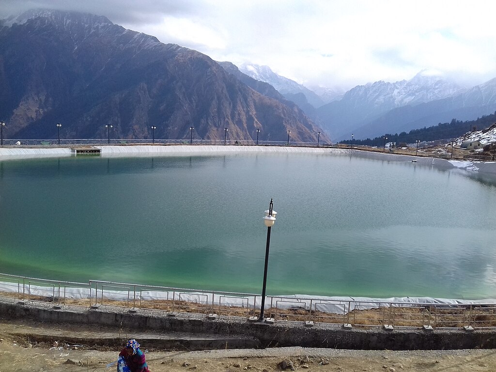
Auli Ropeway Area: ~2,750–2,800 m
-
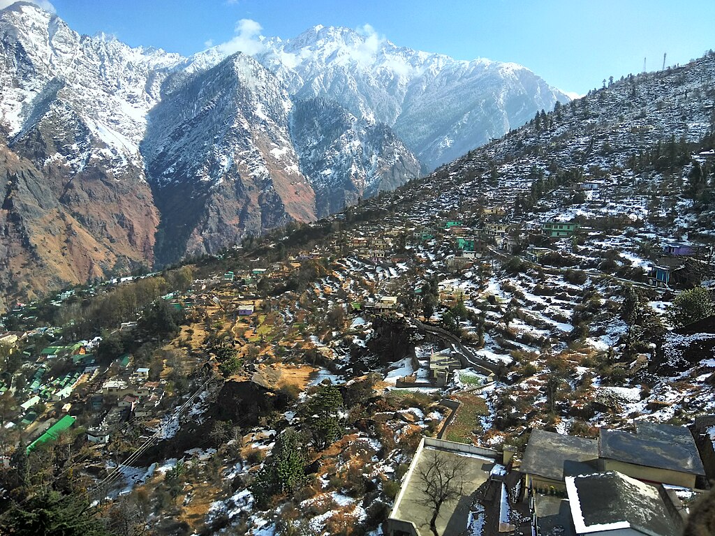
Nearby Joshimath (base town): ~1,890 m
This significant height difference between Joshimath and Auli is one reason the Auli ropeway is among the highest and longest cable cars in India.
You can compare this elevation with other Himalayan destinations like
Yamunotri height from sea level and Tawang altitude to understand Auli’s high-mountain positioning.
Where Is Auli Located?
Auli is located in the Chamoli district of Uttarakhand, around 16 km from Joshimath, a major pilgrimage and transit town. It lies close to the Nanda Devi Biosphere Reserve, a UNESCO-recognized ecological zone.
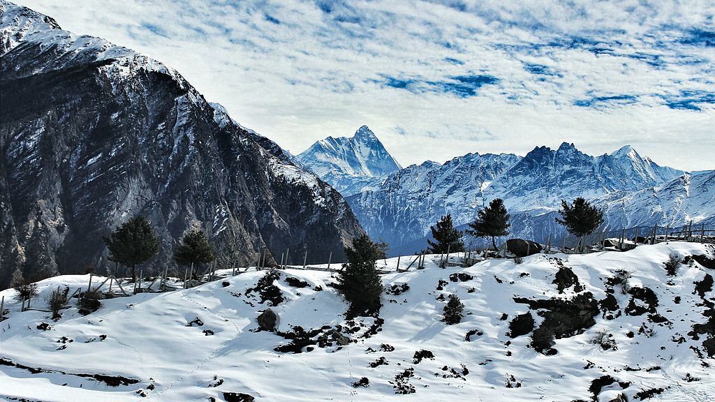
Geographically, Auli is surrounded by towering Himalayan peaks such as:
-
Nanda Devi
-
Mana Parvat
-
Kamet
-
Dunagiri
Because of its high elevation, Auli offers uninterrupted views of snow-clad mountains, especially during winter and early summer.
Why Auli’s Height From Sea Level Is Important
The height of Auli from sea level directly influences:
-
Heavy snowfall during winter
-
Cool temperatures even in summer
-
Skiing conditions and snow quality
-
Vegetation type (alpine meadows and conifers)
-
Lower oxygen levels compared to plains
At nearly 2,800 meters, Auli is much higher than popular hill stations like Mussoorie or Nainital, which explains its colder climate and snow reliability.
Climate of Auli Based on Its Altitude
Because of its high elevation, Auli experiences a cold alpine climate.
Average Temperature by Season
-
Winter (Dec–Feb): –4°C to 7°C
-
Spring (Mar–Apr): 5°C to 15°C
-
Summer (May–Jun): 10°C to 20°C
-
Monsoon (Jul–Sep): Cool but wet, 8°C to 15°C
Snowfall typically begins in late November and continues till February, making Auli ideal for winter sports.
Similar altitude-based weather patterns can be seen at
Ranikhet height from sea level and Kinner Kailash altitude, though Auli is more accessible.
Auli and Skiing: Altitude Advantage
Auli’s elevation is the main reason it is India’s top skiing destination.
How Height Helps Skiing
-
Consistent snowfall due to high altitude
-
Long ski season (Dec–Mar)
-
Stable snow quality
-
Wide alpine slopes ideal for beginners and professionals
The Garhwal Mandal Vikas Nigam (GMVN) conducts national and international skiing events in Auli, thanks to its reliable snow cover.
Compared to lower-altitude winter destinations, Auli’s height ensures better skiing conditions year after year.
Does Auli Altitude Cause Health Issues?
At 2,800 meters above sea level, Auli is considered moderately high altitude.
Most travelers do not face serious altitude sickness, but some may experience:
-
Mild breathlessness
-
Headache on first day
-
Fatigue
Tips for Visitors
-
Spend a night in Joshimath before ascending
-
Stay hydrated
-
Avoid alcohol on the first day
-
Walk slowly during initial hours
Auli’s altitude is lower than extreme high-altitude regions like Leh or Mount Kailash, making it safer for most tourists.
Flora and Fauna at Auli Elevation
The elevation supports alpine and sub-alpine vegetation, including:
-
Oak forests
-
Deodar trees
-
Pine and fir
-
Alpine grasslands (bugyals)
Wildlife found in nearby protected areas includes:
-
Himalayan musk deer
-
Snow leopard (rare sightings)
-
Himalayan monal (state bird of Uttarakhand)
The ecosystem here is highly sensitive due to the altitude, which is why sustainable tourism is encouraged.
Best Time to Visit Auli Based on Elevation
-
For Snow & Skiing: December to February
-
For Sightseeing: March to June
-
For Green Meadows: September to October
Monsoon months are less popular due to landslides and reduced visibility, a common issue in high-altitude Himalayan regions.
Auli Height From Sea Level Compared to Other Places
| Place | Height From Sea Level |
|---|---|
| Auli | ~2,800 meters |
| Joshimath | ~1,890 meters |
| Mussoorie | ~2,005 meters |
| Nainital | ~2,084 meters |
| Gulmarg | ~2,650 meters |
| Ooty | ~2,240 meters |
This comparison shows that Auli is among the highest hill destinations in India, especially suited for snow tourism.
How to Reach Auli (Elevation Journey)
-
By Road: Reach Joshimath via Rishikesh–Chamoli route
-
By Ropeway: Joshimath to Auli cable car (ascends over 900 m)
-
By Air: Nearest airport – Jolly Grant, Dehradun
-
By Rail: Nearest railway station – Rishikesh
The steep elevation gain during the ropeway ride offers spectacular valley views.
Final Thoughts: Why Auli’s Elevation Makes It Special
The height of Auli from sea level (2,800 meters) is the foundation of its identity. It creates ideal conditions for snow sports, breathtaking Himalayan views, and a peaceful mountain environment far removed from city heat and pollution.
Whether you visit Auli for skiing, photography, or simply to enjoy crisp mountain air, its elevation guarantees a memorable high-altitude experience.