
Gangotri Height From Sea Level
Gangotri Height From Sea Level – Gangotri is one of the most sacred pilgrimage destinations in India and a vital part of the Char Dham Yatra. Located deep in the Garhwal Himalayas of Uttarakhand, Gangotri holds immense religious significance as the origin of River Ganga. For pilgrims and travelers, understanding the Gangotri height from sea level is essential for planning a safe and comfortable journey.
Due to its high altitude, Gangotri experiences cold weather even in summer, and visitors must prepare for altitude-related challenges. The elevation plays a crucial role in shaping the climate, travel season, health considerations, and overall pilgrimage experience.
Gangotri Height From Sea Level (Exact Elevation)
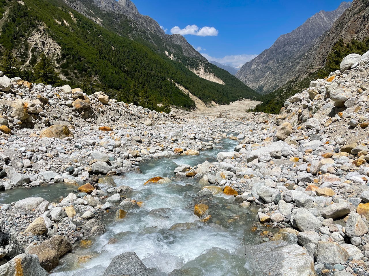
Gangotri is situated at an elevation of approximately 3,100 meters (10,200 feet) above sea level. This places it among the high-altitude Himalayan pilgrimage towns.
Gangotri Elevation Overview Table
| Feature | Details |
|---|---|
| Place Name | Gangotri |
| State | Uttarakhand |
| Height From Sea Level | 3,100 meters |
| Height in Feet | ~10,200 feet |
| Mountain Range | Garhwal Himalayas |
| River Origin | River Ganga |
| Climate Type | Alpine climate |
This significant elevation makes Gangotri one of the coldest Char Dham locations.
Understanding Gangotri Altitude and Its Effects
The altitude of Gangotri has a strong influence on the physical environment and travel conditions.
Key Effects of Gangotri’s Altitude
-
Low oxygen levels compared to plains
-
Cold temperatures even during summer
-
Snowfall from late autumn to early spring
-
Short travel season due to harsh winters
Because of its height, Gangotri remains closed during winter months due to heavy snowfall.
Climate Conditions Based on Gangotri Elevation
The Gangotri height from sea level results in an alpine climate with extreme seasonal variations.
Season-wise Climate Table
| Season | Temperature Range | Travel Experience |
|---|---|---|
| Summer (May–Jun) | 5°C – 15°C | Best time for pilgrimage |
| Monsoon (Jul–Aug) | 5°C – 10°C | Risk of landslides |
| Autumn (Sep–Oct) | 0°C – 10°C | Clear skies, cold nights |
| Winter (Nov–Apr) | Below -10°C | Temple closed |
The moderate summer temperatures make it ideal for pilgrims, while winters are extremely harsh.
Gangotri Elevation and Pilgrimage Significance
Gangotri’s high altitude adds to its spiritual aura. Ancient sages believed that the purity of the Himalayas and the elevation brought devotees closer to divine energy.
-
The temple stands near glaciers and snow-fed streams
-
Meditation and penance were practiced here for centuries
-
The thin air and serene surroundings enhance spiritual focus
The altitude symbolizes detachment from worldly life and closeness to nature and spirituality.
Health Precautions Due to Gangotri Height
Because Gangotri is located above 3,000 meters, travelers should take necessary precautions.
Important Health Tips
-
Acclimatize at lower altitudes like Uttarkashi
-
Stay hydrated and avoid alcohol
-
Walk slowly to prevent breathlessness
-
Carry warm clothing even in summer
-
Consult a doctor if you have heart or respiratory issues
Altitude sickness, though not common, can occur due to Gangotri’s elevation.
Nearby Places and Their Elevation
| Place | Height From Sea Level |
|---|---|
| Gangotri | 3,100 meters |
| Uttarkashi | 1,158 meters |
| Harsil | 2,620 meters |
| Gaumukh Glacier | 4,000 meters |
| Yamunotri | 3,293 meters |
Many pilgrims visit Gangotri as part of a multi-destination Himalayan journey.
Best Time to Visit Based on Altitude
Due to the high elevation of Gangotri, the best travel window is limited.
-
May to June – Ideal weather for darshan
-
September to October – Clear skies and fewer crowds
-
Avoid monsoon due to landslide risk
-
Winters are inaccessible
The temple usually opens on Akshaya Tritiya and closes on Bhai Dooj.
Travel Tips for High-Altitude Gangotri
-
Carry thermal wear, gloves, and jackets
-
Start journeys early to avoid weather changes
-
Keep buffer days for altitude adjustment
-
Respect local customs and environment
Gangotri’s height demands careful planning and responsible travel.
If you’re planning to explore destinations around Gangotri, topchandigarh.com is a helpful blog that provides information about nearby hill stations, pilgrimage towns, and travel routes across North India. It’s especially useful for travelers planning Char Dham Yatra extensions or scenic Himalayan getaways near Uttarakhand.
Conclusion
The Gangotri height from sea level, at approximately 3,100 meters, makes it one of India’s most spiritually powerful and geographically striking pilgrimage destinations. Its high altitude shapes the climate, travel season, and religious significance of the town. With proper preparation and awareness, visiting Gangotri becomes a deeply fulfilling spiritual and natural experience.