

Leh Height From Sea Level
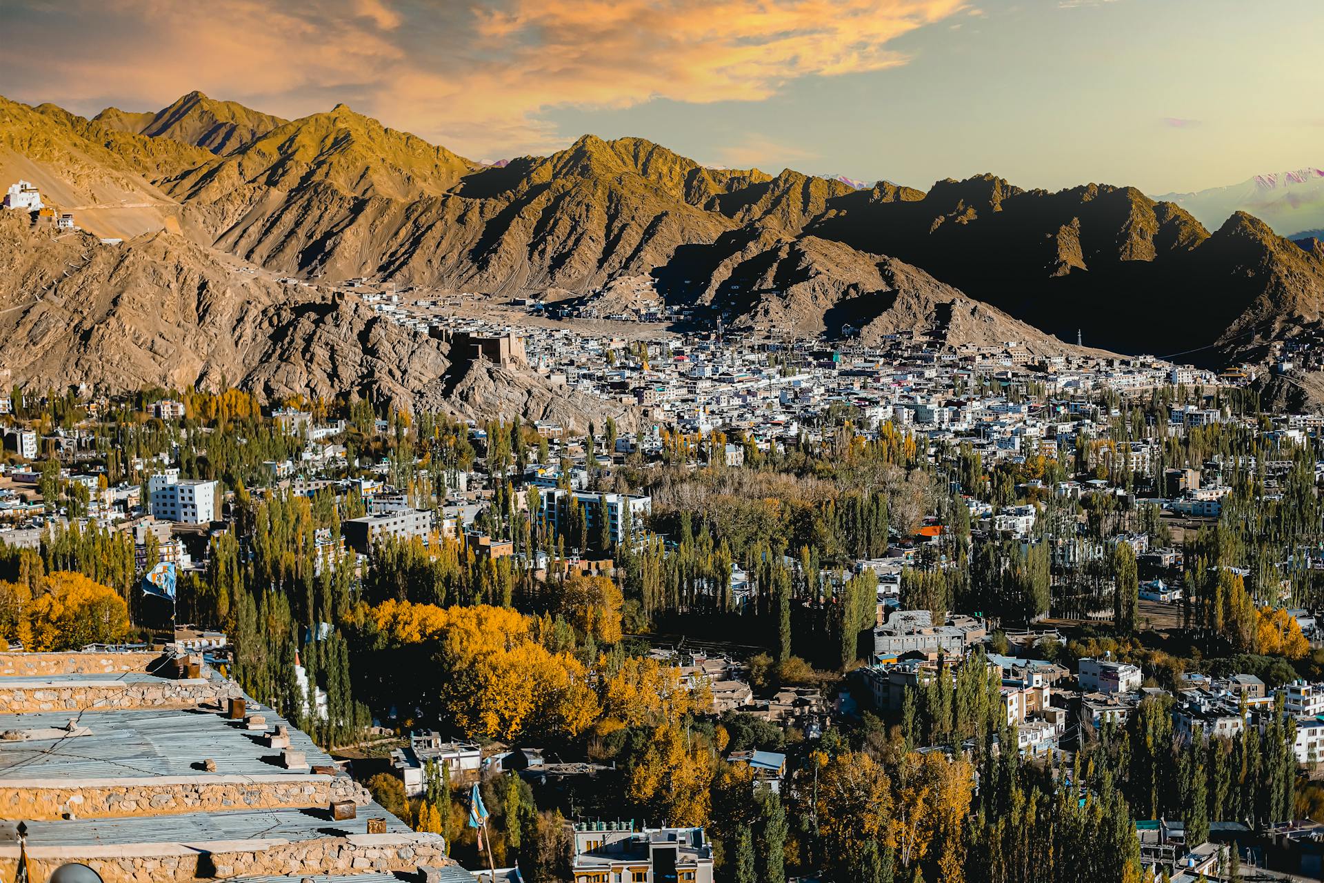
Leh Height From Sea Level – Leh, the capital town of the Union Territory of Ladakh, is one of the highest-inhabited regions in India and a major destination for adventure travelers. Known for its moonlike landscapes, crystal-clear skies, Buddhist monasteries, snow-capped Himalayan peaks, and iconic passes, Leh attracts thousands of tourists every year. However, because of its extreme height, understanding Leh altitude from sea level is crucial before planning any trip.
The Leh height from sea level is approximately 3,505 meters (11,499 feet). At this elevation, the oxygen level is significantly lower than the plains, making acclimatization a critical part of your Leh-Ladakh travel plan. Travelers who understand the altitude and prepare well often enjoy the journey more safely.

⭐ Why Leh Altitude Matters So Much
Leh is located at an elevation that qualifies as High Altitude (above 8,000 ft) and almost reaches Very High Altitude (above 11,500 ft). This impacts tourism, health, climate, and accessibility.
1. Low Oxygen Levels
Due to the height, the oxygen percentage in the air is 40% lower than sea level.
Many first-time travelers experience:
-
Breathlessness
-
Dizziness
-
Mild headaches
-
Fatigue
This is known as Acute Mountain Sickness (AMS).
2. Harsh Weather Conditions
At such height, Leh experiences:
-
Cold desert climate
-
Intense sun during the day
-
Very low temperatures at night
-
Fast-changing climatic conditions
3. Tough Roads & High Passes
Major routes leading to Leh include:
-
Khardung La (5,359 m)
-
Chang La (5,391 m)
-
Tanglang La (5,328 m)
These are among the world’s highest motorable roads.
Table: Key Elevation Details of Leh
| Category | Details |
|---|---|
| Leh Height From Sea Level | 3,505 meters (11,499 feet) |
| Region | Ladakh, Northern Himalayas |
| Climate Type | Cold Desert, High Altitude |
| Summer Temperature | 5°C – 25°C |
| Winter Temperature | -5°C to -20°C |
| Air Oxygen Level | ~60% of sea-level oxygen |
| Best Time to Visit | May–September |
| Snowfall | Heavy during winter |
This table makes it easier to understand Leh’s extreme elevation and weather.
Climate of Leh Based on Its Altitude
Leh’s climate is directly shaped by its location in the high-altitude trans-Himalayan zone. Here’s how each season feels at 3,505 meters:
🌤 Summer (May–September)
-
The most pleasant and safest time to visit Leh
-
Temperatures range between 10°C to 25°C
-
Ideal for sightseeing, trekking, Pangong Lake, and Nubra Valley trips
❄ Winter (October–April)
-
Leh becomes extremely cold
-
Temperatures drop to -20°C or lower
-
Roads close due to snow
-
Only experienced and prepared travelers or locals remain
How Leh’s Height Impacts Tourism
1. Acclimatization Is Mandatory
Most travelers need 24–48 hours to adapt to the low oxygen levels.
Doctors recommend:
-
Rest on Day 1
-
Avoiding alcohol
-
Drinking plenty of water
-
Sleeping well
2. Challenging Terrain
The high passes, rugged mountains, and rough roads make road trips adventurous but demanding.
3. Breathtaking Views
The altitude brings unmatched views of:
-
Stok Kangri
-
Hemis National Park
-
Magnetic Hill
-
Pangong Lake
-
Nubra Valley
-
Shanti Stupa
Clear skies and minimal pollution make Leh perfect for photography.
4. Adventure Activities
Altitude allows for:
-
High-altitude trekking
-
River rafting in Zanskar
-
Biking expeditions
-
Camping under starry skies
Comparison: Leh vs Other High-Altitude Tourist Spots
| Destination | Elevation |
|---|---|
| Leh | 3,505 m |
| Manali | 2,050 m |
| Srinagar | 1,585 m |
| Spiti (Kaza) | 3,800 m |
| Gulmarg | 2,650 m |
| Kathmandu | 1,400 m |
Leh ranks among the highest-accessible towns in India.
Acclimatization Tips for Leh (Based on Altitude)
✔ Rest for the first 24 hours
✔ Avoid smoking & alcohol for the first 48 hours
✔ Drink water frequently
✔ Do not trek or ride to high passes immediately
✔ Keep oxygen cans if needed
✔ Eat light and nutritious meals
✔ Start sightseeing gradually
✔ Consult a doctor if AMS symptoms worsen
Best Places to Visit in Leh & Their Elevation
| Place | Height (meters) |
|---|---|
| Leh Town | 3,505 m |
| Khardung La | 5,359 m |
| Pangong Lake | 4,350 m |
| Nubra Valley | 3,048 m |
| Magnetic Hill | 3,200 m |
| Hemis Monastery | 3,524 m |
These elevation differences help travelers plan their routes safely.
Leh Roads & Accessibility
You can reach Leh by:
-
Flight: Easiest but sudden altitude exposure
-
Manali–Leh Highway: Open from June to September
-
Srinagar–Leh Highway: Smoother and safer route
The dramatic change in elevation along these routes makes the journey breathtaking.
High Altitude Precautions for Leh
Because Leh is at extreme height, follow these precautions:
-
Keep warm clothing
-
Carry travel medicines
-
Do not overexert during the first 48 hours
-
Avoid traveling to Pangong or Khardung La on Day 1
-
Use sunscreen; UV rays are stronger at high elevation
-
Travel slowly to adapt to altitude changes
If you’re looking for reliable travel information and guides to destinations like Ladakh, Himachal, Uttarakhand, and nearby places, TopChandigarh.com is a helpful blog to follow. It offers well-researched articles on tourist attractions, travel routes, local weather, and nearby sightseeing options. Whether you’re planning a road trip, a hill station getaway, or searching for hidden gems around major cities, TopChandigarh.com provides practical insights to make your travel easier and better informed.