
Ranikhet Height From Sea Level – Complete Guide
Ranikhet Height From Sea Level – Ranikhet is one of the most serene and picturesque hill stations in Uttarakhand, India. Famed for its peaceful ambiance, lush forests, and panoramic Himalayan views, it’s a favorite destination for nature lovers, honeymooners, and peace seekers. In this guide, we’ll dive deep into the Ranikhet height from sea level, what the elevation means for climate and tourism, and helpful travel insights for your next trip. Uttarakhand Tourism
What Is Ranikhet Height From Sea Level?
Ranikhet is located at an **average elevation of approximately 1,869 meters (6,132 feet) above sea level. Uttarakhand Tourism+1
This hill station sits nestled in the Almora district of Uttarakhand in the Kumaon region of the Himalayas, giving visitors cool weather, beautiful landscapes, and clean mountain air throughout the year. Uttarakhand Tourism
Why Does Ranikhet’s Elevation Matter?
Ranikhet height from sea level shapes almost every aspect of the town’s character — from its climate and weather to its tourism appeal and even local culture.
1. Climate & Weather
At nearly 1,869 meters above sea level, Ranikhet enjoys a temperate mountain climate:
-
Summers: Mild and pleasant, perfect for escaping heat.
-
Monsoon: Cool with rainfall, lush greenery all around.
-
Winters: Cold, with occasional snowfall and frost. Uttarakhand Tourism
The elevation ensures cool breezes even in peak summer months, making it ideal for tourists seeking a respite from hot plains. Uttarakhand Tourism
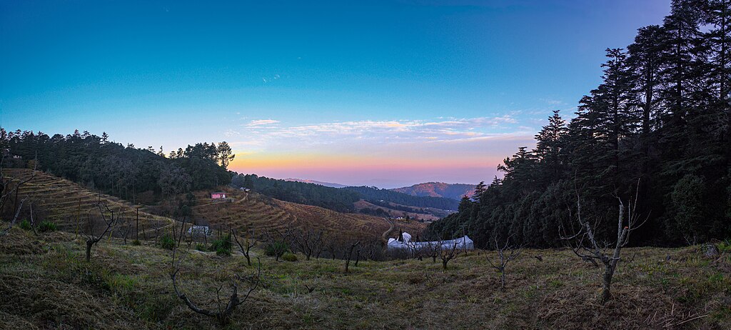
The Geography of Ranikhet
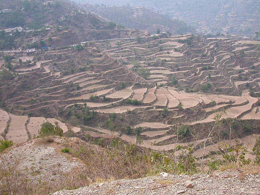
Ranikhet is perched on a ridge of the Kumaon Hills, giving it unique topography and scenic views. Wikipedia
-
Ranikhet Ridge: Around 5,983 feet above sea level.
-
Chaubattia Ridge: Around 6,942 feet above sea level. Wikipedia
These ridges make the area wonderfully varied, with slopes, meadows, and viewpoints offering stunning vistas of the Himalayas. nainitaltourism.com
Ranikhet’s Elevation — What It Means for You
✔ Cool Summers
Thanks to its high altitude, Ranikhet avoids the scorching heat that many parts of northern India experience in summer. It’s a refreshing escape, with temperatures that are comfortable and pleasant. Uttarakhand Tourism
✔ Beautiful Winters
Winters here are brisk and often snowy. The elevation provides the perfect backdrop for a snowy getaway — ideal for nature lovers and photographers. Uttarakhand Tourism
✔ Mountain Views & Fresh Air
Being at around 1,869 meters, Ranikhet offers fresh mountain air and magnificent views of peaks like Nanda Devi and other parts of the Himalayas visible on clear days. Visit My Uttarakhand
Ranikhet’s Height Compared to Nearby Hill Stations
Here’s how Ranikhet’s elevation stacks up against nearby popular hill stations:
| Hill Station | Approx. Height From Sea Level |
|---|---|
| Ranikhet | ~1,869 m (6,132 ft) above sea level Uttarakhand Tourism |
| Nainital | ~1,938 m (6,358 ft) above sea level Wikipedia |
| Almora | ~1,646 m (5,400 ft) above sea level Wikipedia |
This comparison shows that Ranikhet’s elevation is slightly lower than Nainital but still high enough to offer cool climate, snow in winter, and beautiful mountain landscapes. Wikipedia
What to Expect in Ranikhet’s Weather by Elevation
Because of its elevation, Ranikhet experiences weather that varies widely with the seasons:
Spring & Summer (Mar–Jun)
-
Pleasant, mild climate
-
Ideal for sightseeing, outdoor walks, and adventures
Monsoon (Jul–Sep)
-
Cool and wet weather
-
Lush green scenery and blooming flora
Autumn (Oct–Nov)
-
Clear skies with stunning mountain views
-
Best time for photography and trekking
Winter (Dec–Feb)
-
Cold temperatures and snowfall
-
Cozy cabins, winter walks, and a snow-filled environment
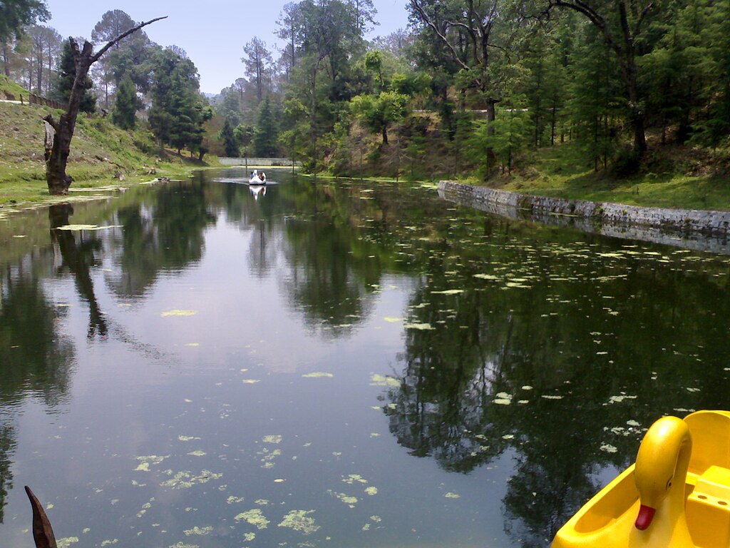
Geography & Landscape Around Ranikhet
Ranikhet is more than just a hill station — it’s a living canvas of Himalayan beauty:
-
Dense forests: Pine, oak, and deodar trees cover much of the region. Krishikosh
-
Meadows & orchards: Soft grassy ridges and Chaubattia gardens add charm to the scenery. nainitaltourism.com
-
Himalayan views: Peaks like Nanda Devi are visible from parts of Ranikhet on clear days. Visit My Uttarakhand
This combination of elevation and terrain makes Ranikhet ideal for travelers, hikers, and peace seekers alike. Uttarakhand Tourism
How to Reach Ranikhet (Elevation Travel Tips)
Ranikhet’s elevation doesn’t make it difficult to access, but weather and altitude should be considered:
By Road
-
Well-connected by road from major cities like Haldwani, Kathgodam and Almora. kumaon.gov.in
Nearest Airports & Railheads
-
Pantnagar Airport is the closest airport (about 119 km away). kumaon.gov.in
-
Kathgodam Railway Station is the nearest major railhead, connected to the Indian Railways network. kumaon.gov.in
At this elevation, most visitors won’t experience altitude sickness, but carrying warm clothing in winter is crucial due to cold and possible snowfall. Uttarakhand Tourism
Things to Do in Ranikhet’s Mountain Atmosphere
Thanks to its elevation and natural setting, Ranikhet offers a variety of experiences:
1. Visit Chaubattia Gardens
Famous for fruit orchards and flower gardens with Himalayan views. nainitaltourism.com
2. Explore Mankameshwar Temple
An ancient temple perched on a hill offering spiritual calm and scenic beauty. Uttarakhand Tourism
3. Army Museum & Golf Course
Learn about military history and enjoy leisurely golf at elevation. Uttarakhand Tourism
4. Trekking & Nature Walks
Explore easy and moderate mountain trails for sunrise, sunset, and panoramic views. Uttarakhand Tourism
Quick Facts – Ranikhet Height From Sea Level
✔ Average elevation: ~1,869 meters (6,132 feet) above sea level. Uttarakhand Tourism
✔ Location: Almora district, Uttarakhand, India. Uttarakhand Tourism
✔ Terrain: Ridge and plateau landscapes in the Kumaon Himalayas. Wikipedia
✔ Climate: Cool summers and snowy winters due to elevation. Uttarakhand Tourism
Conclusion
Ranikhet’s height from sea level at about 1,869 meters (6,132 feet) makes it a refreshing and scenic hill station in the midst of the Kumaon Himalayas. This elevation not only shapes its pleasant weather and mountain scenery but also makes it an ideal tourist destination throughout the year — whether you’re seeking snow, fresh air, or peace away from urban hustle.